Physiographic Maps of the United States
Here are two shaded relief maps of the USA. Look for the differences in the textures of various parts of the paictures while you think of the concept of 'physicographic province', which means a region where the toopographic featerus share common characteristics.
Different topographic features usually indicate that different geologic proceses or different times in geologic history have been resonsible for the formation of that part of the continent.
|
|
This color shaded relief map clearly shows the topography of the United States, although the provinces are not named. Look a the differences in texture and imagine the boundaries betweeen areas of different appearance. Those boundaries define various 'physiographic provinces'. Within any physiographic province the landscape would have the same general appearance, in the way that California is different from Hawaii or Kansas.Click here or on the map to downlad a larger map. The map is a rather large file (2.7 MB), but once downloaded can be magnified to reveal small details.A smaller version (faster download) is here (0.77 MB) |
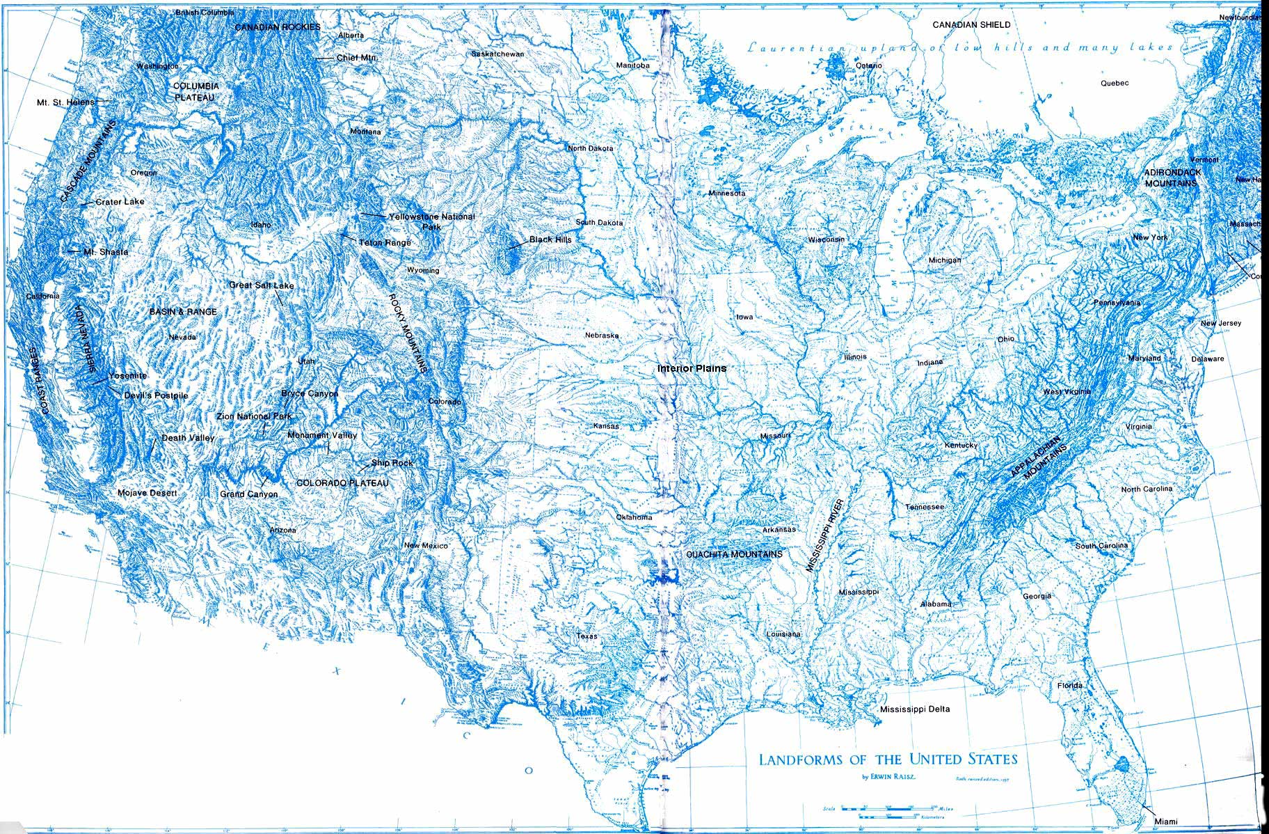 |
This classic map by Erwin Raiz shows the names of the phsyiographic provinces and some specific geologic features..
|
 Geology Is Everywhere!
